
When Disaster Strikes, Every Second Counts. Technology is Making Them Count More.
Remember a time when news of a hurricane or earthquake trickled in slowly, often hours or even days after the event? First responders would rush into a chaotic unknown, armed with little more than paper maps and their own courage. They were working blind. That world, for the most part, is gone. Today, the landscape of emergency management is being fundamentally reshaped by the relentless advance of technology in disaster response. It’s not just about faster computers or better radios; it’s a complete paradigm shift in how we predict, react to, and recover from the worst moments nature can throw at us.
We’re talking about a fusion of data, connectivity, and hardware that gives first responders a level of situational awareness that was pure science fiction just a decade ago. It’s about turning a torrent of chaotic data into actionable intelligence that saves lives. This isn’t a distant future. It’s happening right now, in every corner of the globe.
Key Takeaways
- Predictive Power: AI and IoT sensors are moving us from a reactive to a proactive stance, forecasting disasters with increasing accuracy and enabling timely evacuations.
- Real-Time Awareness: Drones, satellite imagery, and GIS crisis mapping provide first responders with a live, comprehensive view of the disaster zone, allowing for more targeted and efficient rescue operations.
- Streamlined Recovery: Technology is crucial in the aftermath, from assessing damage with AI to managing logistics for aid distribution and helping reconnect separated families through mobile apps.
- Human-Centric Tools: Despite the advanced tech, the goal remains deeply human: to reduce suffering, save lives, and help communities rebuild faster and stronger.
Before the Storm: The Predictive Edge of Modern Tech
The best way to survive a disaster is to know it’s coming. For centuries, this meant looking at the sky or relying on historical patterns. Now, we have digital soothsayers in the form of incredibly sophisticated algorithms and a network of silent sentinels. The game has changed from reaction to prediction.
The Power of AI and Machine Learning
Artificial intelligence is no longer just a buzzword. In meteorology and seismology, it’s a powerhouse. Machine learning models can analyze immense datasets—we’re talking petabytes of historical weather patterns, ocean temperatures, atmospheric pressure readings, and even subtle seismic shifts—to identify patterns invisible to the human eye. Think about hurricane forecasting. AI can process thousands of variables simultaneously, running countless simulations to predict a storm’s path and intensity with a level of accuracy that was previously unimaginable. This isn’t just about knowing where the storm will hit; it’s about predicting storm surge with terrifying precision, allowing authorities to issue highly specific evacuation orders for low-lying areas. It’s the difference between telling a whole state to evacuate and telling specific neighborhoods. That’s a life-saving distinction.
IoT Sensors: The Planet’s Nervous System
Imagine a vast, invisible network of sensors acting as the Earth’s nervous system. That’s what the Internet of Things (IoT) is creating. Thousands of low-cost sensors are being deployed in rivers, on mountainsides, and along coastlines. River gauges with IoT connectivity can stream real-time water level data, automatically triggering flood alerts when a critical threshold is reached. Acoustic sensors on volcanoes can detect the unique rumbles that precede an eruption. Strain gauges on bridges and buildings can report back on structural integrity after an earthquake. These aren’t just data points; they are whispers of an impending crisis, giving us precious minutes or hours to prepare. It’s a quiet, constant vigilance that provides the raw data our AI models need to thrive.
Getting the Word Out: Advanced Alert Systems
An early warning is useless if it doesn’t reach the people in harm’s way. The days of relying solely on a town siren are over. Today, systems like the Wireless Emergency Alerts (WEA) can push notifications directly to every mobile phone in a specific geographic area. You’ve probably gotten one. It’s that loud, unmissable buzz for an AMBER Alert or a flash flood warning. Social media platforms have also become critical channels for disseminating information, with agencies using Twitter and Facebook to provide real-time updates and instructions. This multi-pronged approach ensures that the message cuts through the noise of daily life, reaching people where they are: on their phones.
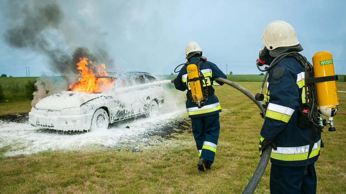
During the Chaos: Technology in the Thick of the Response
When a disaster strikes, the first 72 hours are critical. This is the golden window for search and rescue. It’s a period defined by chaos, misinformation, and immense pressure. This is where technology in disaster response truly shines, cutting through the fog of war to bring clarity and direction.
Drones: The Eyes in the Sky
When roads are impassable and infrastructure has crumbled, getting a clear view of the situation is the first major hurdle. Drones, or Unmanned Aerial Vehicles (UAVs), have become one of the most indispensable tools for first responders. They are cheap, fast, and can go where humans can’t. A small, remotely-operated drone can launch in minutes and stream back high-definition video of a collapsed building, a flooded neighborhood, or a raging wildfire. Some are equipped with thermal cameras, allowing them to spot the heat signature of a survivor trapped under rubble, even in the dead of night. They’re not just for surveillance, either. Larger drones are being tested to deliver small, critical payloads like medicine, water, or even temporary communication devices to isolated survivors. They are the ultimate reconnaissance tool.

GIS and Crisis Mapping: The Digital Command Center
Situational awareness is everything. Geographic Information Systems (GIS) are powerful software tools that layer different types of data onto a map. Imagine a digital map of a disaster zone. Now, let’s add layers: a layer showing all the damaged buildings from satellite imagery, a layer showing which roads are blocked, a layer showing the real-time location of all your rescue teams, and another layer showing 911 calls as they come in. That’s GIS. It transforms a flat map into a living, breathing command center that allows incident commanders to make strategic decisions about where to allocate their limited resources for maximum impact.
This is often supercharged by crowdsourcing. Platforms like Ushahidi, born out of the 2007 Kenyan election crisis, allow ordinary citizens to report incidents via text message or a web form. This data is then instantly plotted on a map. Someone can report a downed power line, a request for medical help, or a safe source of drinking water. This creates a rich, ground-level view of the situation that complements the bird’s-eye view from drones and satellites. It’s a powerful collaboration between citizens and responders.
Communication is King: Keeping Lines Open
In almost every major disaster, the first thing to fail is communication. Cell towers get damaged or overwhelmed. Power goes out. Without communication, a coordinated response is impossible. Teams can’t talk to each other, commanders can’t direct assets, and survivors can’t call for help. Technology is providing robust solutions. Satellite phones, which are no longer the clunky, expensive bricks they once were, provide a reliable link when terrestrial networks are down. Portable, deployable cell towers, known as COWs (Cells on Wheels), can be brought in to restore cellular service to a specific area within hours. Furthermore, mesh networking technologies allow mobile devices to connect directly with each other, creating a decentralized, ad-hoc network that doesn’t rely on a central tower. It’s all about creating redundant, resilient communication lifelines.
The Aftermath: Streamlining Recovery and Rebuilding Hope
The response doesn’t end when the shaking stops or the waters recede. The recovery phase can last for months or even years. Technology is playing a vital role here, too, helping communities get back on their feet faster and more efficiently.
Assessing the Damage from Above
How do you quickly and accurately determine the extent of damage across hundreds of square miles? You can’t go door-to-door; it would take forever. This is where high-resolution satellite and aerial imagery comes in. Companies can task satellites to capture images of an area immediately after a disaster. Then, AI algorithms are used to compare the ‘after’ pictures with the ‘before’ pictures. The AI can automatically identify and tag every damaged roof, every collapsed bridge, and every flooded street. This provides governments and insurance agencies with a rapid, macro-level assessment of the damage, which is critical for allocating federal aid and processing claims. It shaves weeks or months off the traditional assessment process.

Managing Aid with Logistics Software
The aftermath of a disaster often sees an outpouring of generosity. Donations of food, water, and supplies pour in. But this can quickly turn into a logistical nightmare. Warehouses get filled with unsolicited, unsorted items, and getting the right aid to the right people becomes a massive challenge. Modern logistics and supply chain management software, the same kind used by giants like Amazon, is now being used by aid organizations like the Red Cross. This software allows them to track donations from the source, manage inventory in real-time, and coordinate distribution efficiently. It ensures that critical medical supplies don’t get stuck behind a pallet of teddy bears. It brings order to chaos.
Connecting Survivors: Apps and Digital Tools
In the frantic moments of an evacuation, families often get separated. Digital tools have become essential for reconnection. Facebook’s Safety Check feature allows users in a disaster area to quickly mark themselves as safe, reassuring friends and family. The American Red Cross has apps that help people find open shelters or prepare for emergencies. Other tools help create digital registries of missing persons. These simple applications leverage the power of social networks and the ubiquity of smartphones to address a deeply human need: knowing your loved ones are okay.
“Technology is at its best when it serves humanity. In a crisis, a simple app that reconnects a child with their parent is more powerful than the most advanced algorithm. It’s about using these tools to restore a sense of normalcy and hope amidst the devastation.”
The Human Factor: Challenges and Ethical Considerations
For all its incredible potential, technology is not a magic bullet. Its implementation comes with significant challenges that we must address thoughtfully. This isn’t just about cool gadgets; it’s about people.
The Digital Divide
What happens when emergency alerts are sent to smartphones, but a significant portion of the vulnerable population—like the elderly or those in low-income communities—doesn’t own one? This is the digital divide. An over-reliance on high-tech solutions can inadvertently leave the most vulnerable behind. Disaster response plans must remain multi-modal, incorporating low-tech solutions like radio broadcasts, door-to-door warnings, and community-based alert systems to ensure everyone gets the message.
Data Privacy and Security
During a crisis, a massive amount of personal data is collected—location data from mobile phones, imagery from drones, personal information for aid registration. This raises serious privacy concerns. This data must be protected with robust security measures to prevent it from being misused. There needs to be a clear and ethical framework governing how this data is collected, used, and stored, especially when it involves private companies assisting in the response effort.
Technology is a Tool, Not a Savior
Finally, we must never forget that technology is a tool to empower human responders, not replace them. A drone can spot a survivor, but it can’t pull them from the rubble. A GIS map can identify a hotspot, but it can’t comfort a family that has lost everything. The empathy, courage, and ingenuity of human beings—both professional responders and ordinary citizens helping their neighbors—will always be the most critical element of any disaster response. The technology simply makes them better, faster, and safer.
Conclusion
The role of technology in disaster response is no longer a question of ‘if’ but ‘how’. From the predictive power of AI that warns us of danger, to the real-time eyes of a drone guiding rescuers, to the logistical software that ensures aid reaches those who need it most, technology has become a powerful ally in our constant struggle against natural forces. It is augmenting our capabilities, sharpening our focus, and ultimately, increasing our capacity for compassion and effectiveness in the face of tragedy. The challenges of equity and privacy are real and must be navigated with care, but the trajectory is clear. As technology continues to evolve, so too will our ability to protect our communities, save lives, and rebuild with ever-greater resilience.

 The Ethics of AI Content: Bias, Truth, and Ownership
  Serverless Architecture: The Ultimate Guide for Developers
  AI Translating Ancient Texts: A Digital Rosetta Stone
  Improving Mental Health Diagnostics with Technology
  How Tech Creates More Inclusive Banking for All
  Beyond Passwords: The Future of Authentication Is Here
  Backtest Crypto Trading Strategies: A Complete Guide
  NFT Standards: A Cross-Chain Guide for Creators & Collectors
  Decentralized Storage: IPFS & Arweave Explained Simply
  How to Calculate Cryptocurrency Taxes: A Simple Guide
  Your Guide to Music NFTs & Top Platforms for 2024
  TradingView for Crypto: The Ultimate Trader’s Guide